


PERRY 7, Martin County, Indiana
About
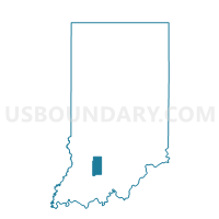
Outline

Summary
| Unique Area Identifier | 579709 |
| Name | PERRY 7 |
| County | Martin County |
| State | Indiana |
| Area (square miles) | 72.90 |
| Land Area (square miles) | 71.33 |
| Water Area (square miles) | 1.57 |
| % of Land Area | 97.85 |
| % of Water Area | 2.15 |
| Latitude of the Internal Point | 38.81260240 |
| Longtitude of the Internal Point | -86.85671620 |
Maps


Graphs
Select a template below for downloading or customizing gragh for PERRY 7, Martin County, Indiana


Neighbors
Neighoring Voting District (by Name) Neighboring Voting District on the Map
- BARR 2, Daviess County, IN
- CRANE, Martin County, IN
- JACKSON, Greene County, IN
- MADISON 1, Daviess County, IN
- MADISON 2, Daviess County, IN
- MITCHELTREE, Martin County, IN
- NORTH CENTER, Martin County, IN
- PERRY 6, Martin County, IN
- TAYLOR, Greene County, IN
- VAN BUREN 1, Daviess County, IN
Top 10 Neighboring County Subdivision (by Population) Neighboring County Subdivision on the Map
- Perry township, Martin County, IN (5,093)
- Barr township, Daviess County, IN (4,811)
- Madison township, Daviess County, IN (2,840)
- Van Buren township, Daviess County, IN (2,552)
- Jackson township, Greene County, IN (1,947)
- Center township, Martin County, IN (1,654)
- Taylor township, Greene County, IN (1,200)
- Mitcheltree township, Martin County, IN (624)
Top 10 Neighboring Place (by Population) Neighboring Place on the Map
Top 10 Neighboring Unified School District (by Population) Neighboring Unified School District on the Map
- North Daviess Community Schools, IN (8,881)
- Eastern Greene County School District, IN (8,077)
- Bloomfield School District, IN (6,937)
- Loogootee Community School Corporation, IN (5,853)
- Barr-Reeve Community School Corporation, IN (5,442)
- Shoals Community School Corporation, IN (4,481)
Top 10 Neighboring State Legislative District Lower Chamber (by Population) Neighboring State Legislative District Lower Chamber on the Map
- State House District 63, IN (64,153)
- State House District 62, IN (60,681)
- State House District 45, IN (59,062)
Top 10 Neighboring State Legislative District Upper Chamber (by Population) Neighboring State Legislative District Upper Chamber on the Map
Top 10 Neighboring 111th Congressional District (by Population) Neighboring 111th Congressional District on the Map
Top 10 Neighboring Census Tract (by Population) Neighboring Census Tract on the Map
- Census Tract 9545, Daviess County, IN (9,228)
- Census Tract 9547.01, Greene County, IN (4,587)
- Census Tract 9502, Martin County, IN (3,865)
- Census Tract 9543, Daviess County, IN (3,758)
- Census Tract 9501, Martin County, IN (2,669)
Top 10 Neighboring 5-Digit ZIP Code Tabulation Area (by Population) Neighboring 5-Digit ZIP Code Tabulation Area on the Map
- 47424, IN (9,525)
- 47553, IN (8,495)
- 47562, IN (4,658)
- 47581, IN (3,883)
- 47453, IN (498)
- 47522, IN (246)